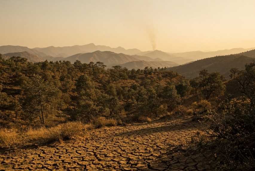
Northern Algeria holds almost all of the country’s forests. That narrow Mediterranean belt—mountains, oak and pine stands, maquis shrubland, villages, and farms—sits between the sea and the Sahara. In summer it becomes one of North Africa’s most fire-prone landscapes.
Wildfires in Algeria are not a single disaster. They are a recurring seasonal risk that can, in bad years, kill dozens of people, destroy homes and olive groves, and wipe out tens of thousands of hectares of vegetation in a few days. The 2021, 2022, and 2023 seasons made that reality impossible to ignore. Later years showed that stronger prevention and aerial firefighting can reduce burned area—but they did not remove the underlying danger.
This article explains why Algeria is vulnerable, where fires start, what causes them, how climate change changes the odds, what major seasons actually did, and how science and technology can support prevention without pretending that satellites or artificial intelligence can replace forest management and community caution.
Key Facts
Algeria’s forest heritage is concentrated in the north. The Directorate General of Forests (DGF) cites about 4.1 million hectares of forest-related cover, of which roughly 1.32 million hectares are productive forest, with an afforestation rate near 11% in the north. By the stricter FAO/World Bank “forest area” definition, forest covers under 1% of Algeria’s total land area because most of the country is arid or desert.
Between 1985 and 2023, DGF-based research recorded 76,427 fires and about 1.41 million hectares burned—on average around 1,960 fires and 36,000 hectares a year.
The World Bank has used a similar long-term picture: more than 75,000 forest fires from 1985 to 2022, with an average of about 35,000 hectares burned each year.
2021 was among the worst recent seasons: DGF reported more than 100,000 hectares of vegetation affected and 1,631 fire outbreaks in 21 wilayas. Satellite products that map larger fires put burned area near 133,000 hectares. Official death tolls for the season have been reported as 90 in contemporaneous accounts and later as 103 by the Interior Ministry.
Deadly seasons followed: August 2022 fires in the northeast, especially El Tarf, killed at least 37–44 people in the main wave; the Interior Ministry later cited 47 deaths for 2022 as a whole. July 2023 fires killed 34 people, including 10 soldiers.
Officials later said burned area fell sharply in 2024 and 2025. In March 2026 the minister responsible for forests reported 5,289 hectares burned in 2025, about 90% below a decade average he put at 40,000 hectares. Satellite mapping for 2025 still recorded a higher figure (22,030 hectares from 847 fires in an EFFIS advance report), showing why sources must be compared, not mixed.
Forest services in Algeria have long stated that the large majority of fires—often cited as more than 90%—are of human origin. Climate conditions make fires more likely and more severe; they do not by themselves light most of them.
A Mediterranean Fire Problem in North Africa
When people picture Algeria, they often picture the Sahara. The fire problem lives elsewhere. Almost all forest fires occur in the humid and sub-humid north: Kabylia, the coastal Tell Atlas, and the forested northeast toward Tunisia.
That geography matters. Mediterranean summers are already hot and dry. Vegetation that grew during wetter winters becomes fuel by July and August. Steep mountains channel wind and slow fire engines. Villages and farms sit inside or beside woodland. A fire that starts as a small agricultural burn or an abandoned campfire can, under heat and wind, become a landscape fire in hours.
The consequences are layered:
Human: deaths, burns, evacuations, destroyed houses, and lasting trauma.
Social: rural families lose trees, livestock, and a year of work.
Environmental: forest and maquis are removed, soils are exposed, wildlife is killed or displaced, and smoke pollutes the air.
Economic: agriculture, forestry, infrastructure, emergency operations, and local tourism all take losses.
Algeria is not unique. Spain, Portugal, Greece, Italy, Turkey, Morocco, and Tunisia face the same Mediterranean fire climate. Algeria’s version is shaped by a thin forest belt, rugged terrain, dense rural settlement in some mountain wilayas, and a fire-response system that has been rebuilt after the shocks of 2021–2023.
Why Algeria Is Vulnerable to Wildfires
Mediterranean climate
Northern Algeria has a classic Mediterranean climate: mild, wetted winters and hot, dry summers. Fuel grows when rain is available, then dries when rain stops. Fire is therefore concentrated in space (the north) and in time (mainly summer, with some activity in late spring and autumn).
Heat, drought, and wind
Dangerous fire weather combines high temperature, low humidity, dry vegetation, and wind. In major crisis years, local reports described temperatures around 47–50°C in affected wilayas. Heatwaves do not “cause” every fire, but they dry live and dead vegetation, raise the Fire Weather Index, and make suppression harder for crews working in mountains.
Drought works more slowly. Weeks or months with little rain lower soil moisture and plant water content. Dead grasses, leaf litter, and drought-stressed shrubs then ignite more easily and burn more completely.
Strong winds—including hot, dry flows off interior plateaus—push flames upslope, throw sparks across roads and firebreaks, and close the window in which a small fire can still be stopped.
Forests, mountains, and fuel
Algeria’s northern forests include oak, pine, mixed woodland, and extensive maquis and scrub. These vegetation types can carry fire quickly in summer. Mountainous terrain in Tizi Ouzou, Béjaïa, Jijel, Skikda, and neighboring wilayas creates:
rapid upslope spread
limited road access
dangerous working conditions for ground crews
pockets where aerial drops are the only fast option
Fuel also accumulates where grazing, thinning, or controlled vegetation management is weak. Abandoned agricultural edges and the wildland–village interface add both fuel and ignition sources.
Climate-change-related risk
The Mediterranean is widely identified in climate science as a warming and drying hotspot. For Algeria, that does not mean every fire is “caused by climate change.” It means the background conditions that turn an ignition into a large, fast fire are becoming more common: hotter extremes, longer dry spells, and a fire season that models project could lengthen by several weeks in northern Algeria under higher warming levels. Those are risk multipliers, not a substitute for knowing how a given fire started.
Where Wildfires Occur Most Frequently
Fire maps show a sharp north–south contrast. In the arid south, vegetation is too sparse to support frequent large forest fires. In the north, productive woodland and shrubland provide fuel.
High-risk provinces in recent severe seasons have repeatedly included:
Tizi Ouzou and Béjaïa (Kabylia)
Jijel, Skikda, Boumerdès, Bouira
El Tarf, Annaba, Guelma, Souk Ahras in the northeast
other northern and near-coastal wilayas such as Tipaza, Médéa, Sétif, and Khenchela in some years
In 2021, DGF figures highlighted Tizi Ouzou with 241 outbreaks and about 43,400 hectares affected, and Béjaïa with 112 outbreaks and about 13,200 hectares. Jijel, Skikda, Tipaza, Bouira, and El Tarf also ranked high in outbreak counts.
Several land-use patterns raise local risk:
Forest density supplies continuous fuel.
Mountains speed spread and slow access.
Rural communities live inside the fuel bed.
Agricultural land brings seasonal burning, machinery, and field edges.
Urban and village expansion creates a wildland–urban interface where a vegetation fire becomes a housing emergency.
Human activity—roads, power lines, picnics, waste burning—adds ignition.
Scientific mapping of northern Algeria has found fire hotspots concentrated where cropland and built-up areas mix with shrubland and forest, not only in remote wilderness.
Main Causes of Wildfires
A useful rule: weather and fuel control fire behavior; people usually provide the spark.
Natural ignition
Lightning can start fires, especially with dry thunderstorms. In Algeria, as in much of the Mediterranean, lightning is a minority cause compared with human ignition. Natural fires still matter because they can start in remote terrain.
Accidental and negligent fires
Common accidental pathways include:
agricultural burning that escapes
burning of vegetation and crop residues
campfires and picnic fires
discarded cigarettes
sparks from vehicles, machinery, or welding
electrical infrastructure faults, especially in high wind
DGF statements in recent seasons have attributed more than 90% of incidents to human origin. That is a statement about ignition, not a claim that every large fire is intentional.
Deliberate fires
Arson exists in many fire-prone countries. After the 2021 disaster, Algerian officials said many fires appeared coordinated and announced arrests. Those statements should be reported as official allegations and investigations, not as a completed scientific finding for every outbreak. Some fires can be deliberate; many others are accidents that become catastrophes because of heat, wind, and fuel.
Poor land management
Neglected fuel, missing firebreaks, unmanaged forest edges, illegal dumping, and weak control of seasonal burning all raise the chance that a small ignition becomes a landscape fire. Management failures do not ignite fires by themselves. They determine whether a fire has a path.
Climate Change and Wildfire Risk
Climate change affects fire weather, not the match.
Established observations for the wider Mediterranean include rising average temperatures, more intense heatwaves, and pressure on summer water balances. Algeria’s northern fire belt sits inside that pattern. In crisis summers, authorities and meteorological services have warned of extreme heat and water stress at the same time fires were spreading.
What climate change can do:
raise daily maximum temperatures
lengthen heatwave episodes
reduce or redistribute rainfall
dry soils and live vegetation faster
increase the number of days with dangerous Fire Weather Index values
extend the seasonal window in which large fires are possible
A 2026 fire-ecology projection study for the Mediterranean found that, at higher global warming levels, northern Algeria could see a substantial lengthening of the fire season—on the order of many weeks in some modeled areas. That is a projection, with the usual uncertainties of climate models, emissions pathways, and local vegetation change.
What climate change does not automatically do:
decide whether a farmer burns a field
replace the need for firebreaks and early attack
turn every hectare of Algeria into flammable forest (the south remains fuel-limited)
The honest scientific sentence is this: climate change is increasing the likelihood of severe fire weather in Algeria’s Mediterranean north, while most ignitions remain human.
Major Wildfire Events in Algeria
Figures below come from DGF, the Interior Ministry, Civil Protection, IFRC/ReliefWeb, national and international news agencies, and satellite mapping systems such as EFFIS. They do not always match, because agencies count different things: all vegetation versus forest only; all ignitions versus fires above a size threshold; early operational tallies versus later official balances.
Long-term background
1985–2023: about 76,427 fires and 1.41 million hectares burned (DGF-based study published from university forest-research teams).
Average year in that series: roughly 36,000 hectares.
Extreme mapped years in satellite series include 2012 (around 201,000 hectares in one compiled large-fire series) and 2021.
Summer 2021 — Kabylia and the northern belt
Fires intensified from 9 August 2021, especially in Tizi Ouzou and Béjaïa, then across many northern wilayas. Temperatures in affected areas were reported near 49–50°C.
DGF (May 2022): more than 100,000 hectares of vegetation; 1,631 outbreaks; 21 wilayas.
Hardest-hit areas by DGF area: Tizi Ouzou (43,398 ha) and Béjaïa (13,174 ha), with Khenchela, Guelma, El Tarf, and Annaba also above 5,000 hectares.
Human toll: contemporaneous official and media tallies commonly cited 90 deaths, including 33 soldiers trapped during rescue; the Interior Ministry later cited 103 deaths for 2021.
Damage reported in local agricultural services and follow-up accounts included thousands of hectares of fruit trees, tens of thousands of farm animals, and more than 1,700 damaged homes in one technical appraisal cited after the fires.
Interior Ministry later valued 2021 agricultural, livestock, and housing losses at about 15.65 billion Algerian dinars.
The government mobilized Civil Protection, the army, and later moved to expand water-bomber capacity, including Beriev Be-200 aircraft.
Satellite products that focus on larger fires put 2021 burned area near 133,000 hectares, above the DGF vegetation total. The difference is a reminder that “burned area” depends on mapping method.
August 2022 — El Tarf and the northeast
On and after 14–17 August 2022, more than 100 fires affected around 14 northeastern wilayas. El Tarf, near the Tunisian border and the El Kala wetlands and forests, suffered the deadliest concentration.
Local authorities in El Tarf reported 36 deaths in that wilaya’s main wave and 5,670 hectares of vegetation there, including 1,164 hectares of forest, with 173 injured in the wali’s briefing.
National and international agencies reported 37–44 deaths for the broader August crisis, more than 200 injured, evacuation of a mother-and-child medical complex in Souk Ahras, and displacement of more than 500 families (about 2,000 people) in IFRC reporting.
IFRC cited more than 6,000 hectares destroyed in figures sent by wilayas, and said Souk Ahras lost about one-third of its forests in that episode.
The Interior Ministry’s later national balance for 2022 cited 47 deaths, about 28,000 hectares of forest burned, 1,604 outbreaks, and about 1.5 billion dinars in agricultural, livestock, and housing losses.
Early operational burned-area numbers were much smaller than later seasonal totals. That is normal: first briefings describe the active emergency, not the full year.
July 2023 — Béjaïa and the northern heatwave
After prolonged heat—IFRC noted temperatures above 45°C in June and 50°C in July—fires exploded from 23–24 July 2023 across the northeast.
Government figure: 34 confirmed deaths, including 10 soldiers in Béjaïa during evacuation/rescue.
Béjaïa was the center of the human toll; local radio tallies during the crisis put most civilian and military deaths there.
Authorities reported about 97 fires in the peak surge, thousands of emergency personnel, and containment of most fires within a few days as winds eased.
IFRC: about 6,000 families and 30,000 people affected; more than 700 injured in one operations report.
Forest services in Béjaïa later spoke of around 11,000 hectares affected in that wilaya, including thousands of hectares of crops and orchards.
EFFIS satellite mapping for 2023 as a whole: about 73,725 hectares and 620 fires.
2024 and 2025 — smaller burned area, not zero risk
Officials have described 2024 and 2025 as a break in the recent pattern of very large seasonal losses.
A compiled large-fire series (fires above 30 hectares) put 2024 burned area at about 8,158 hectares by late November 2024.
EFFIS mapping for 2024 reported about 10,354 hectares and 369 fires.
In March 2026, at the installation of the National Forest Protection Commission, the minister said 2025 burned area was 5,289 hectares (including 932 hectares outside the official campaign), about 90% below a 40,000-hectare decade average.
An EFFIS 2025 advance report mapped 22,030 hectares from 847 fires, with mixed forest and “other natural land” dominating, and 817 hectares in protected areas. Two fires exceeded 2,000 hectares, including events in October and November—evidence that the calendar of risk is no longer only mid-summer.
Mid-year 2025 press figures citing DGF (hundreds of fires and much larger hectare totals) do not match the later ministerial year-end number. The responsible way to handle that is to treat mid-season operational counts, year-end official balances, and satellite maps as different products.
2026 — an active season still defined by many small fires
As of early September 2026, a full official year-end balance was not the same as a closed historical record. Civil Protection did report intense mid-summer activity: 1,968 fires extinguished from 8 July 2026 in one late-July statement, including 667 forest, scrub, and brush fires and 1,301 fires in crops, fruit trees, and palms during a heatwave. Earlier July updates spoke of more than 1,400 fires since the start of the month and about 1,666 hectares of vegetation affected at that snapshot. Aerial assets—including AT-802 water bombers, Be-200 aircraft, and Mi-26 helicopters—were used again in northern and eastern wilayas in late August.
The 2026 pattern so far looks like many ignitions under heat, with authorities arguing that faster attack has kept most fires from becoming 2021-scale megafires. That assessment should wait for the official close of the season and independent mapping.
Human Impact
Fatalities are the most visible cost. They are not the only one.
Residents of mountain villages have been trapped on roads, in homes, and in vehicles. In El Tarf in 2022, victims included a family found in a house and passengers in a bus overtaken by flames. In 2021 and 2023, soldiers died trying to evacuate civilians—an indication of how quickly fire can close escape routes in Kabylian terrain.
Families lose houses, documents, stored food, and animals. Farmers lose olive trees, fruit orchards, beehives, pasture, and a capital stock that takes years to replace. Rural communities that depend on woodland products, grazing, and small agriculture face a sudden drop in income.
Emergency workers operate in extreme heat, smoke, falling trees, and collapsing slopes. Firefighters and army units have been surrounded by flame fronts. Injuries from burns, smoke, and exhaustion are routinely in the hundreds during major waves.
Evacuations disrupt schools, clinics, and local commerce. IFRC and Red Crescent operations after 2021 and 2022 emphasized psychosocial support because people who survive a fast night fire often replay the same minutes for years: the sound of wind, the decision to leave or stay, the loss of a neighbor.
Wildlife is part of the human landscape in places such as El Kala. Animals die in the fire or afterwards from habitat loss and lack of food. That is an ecological fact and also a cultural shock in communities that live beside those forests.
Environmental Impact
Algeria’s Mediterranean forests and maquis are small compared with the Sahara, but they are disproportionately important. They protect watersheds that feed coastal cities and farmland, hold soils on steep slopes, store carbon, and shelter plants and animals adapted to a narrow climatic band.
Fires damage that system in several ways:
Forest and shrub destruction. Repeated fire can convert woodland to scrub or grassland if regeneration fails.
Wildlife mortality and habitat loss. Fast crown fires leave little refuge.
Biodiversity decline. Protected landscapes and national parks are not immune; EFFIS mapped hundreds of hectares of protected area burned in 2025 alone.
Soil erosion. After vegetation is removed, autumn rains can strip soil from mountainsides.
Desertification risk. On the southern edge of the forest belt, loss of cover can help arid conditions creep north. This is a long-term risk, not an overnight transformation of Kabylia into desert.
Air pollution. Smoke carries fine particles that harm people far from the flame front.
Carbon emissions. Burning biomass releases carbon that the forest would otherwise keep.
Water quality. Ash and sediment wash into streams, springs, and reservoirs.
Slow recovery. Oak and some shrubs resprout; pine recovery depends on seed banks and follow-up grazing or erosion. Full structural recovery of a mature stand can take decades.
A fire is not automatically an ecological catastrophe in every Mediterranean ecosystem—some shrublands are fire-adapted. The problem in Algeria is frequency, intensity, and the overlap with villages, farms, and already fragmented forests.
Economic Impact
Money estimates are incomplete, but official figures give scale.
Interior Ministry: more than 17 billion dinars in public losses from the 2021 and 2022 fire years combined (15.65 billion in 2021 and 1.5 billion in 2022 for agriculture, livestock, and housing).
World Bank summary of the 2021 shock: damage to agriculture and housing alone exceeded US$124 million.
Research citing 2022 costs has used figures on the order of 2.5 billion dinars associated with tens of thousands of hectares of burned forest, plus the 1.5 billion dinars housing and farm figure above.
Loss categories include:
orchards, cereals, and mountain crops
timber and non-timber forest products
livestock
houses and farm buildings
roads, power lines, and communications
firefighting and relief operations
interrupted local tourism in coastal and mountain wilayas
multi-year loss of rural income while trees regrow
For a household, one mature olive grove can be a larger economic event than a national hectare statistic. That is why prevention is also rural economic policy.
Firefighting and Emergency Response in Algeria
Algeria’s operational system is built around several institutions:
Civil Protection (Protection civile): first response, evacuations, ground columns, and increasingly aerial coordination.
Directorate General of Forests (DGF): forest domain, prevention, lookouts, and field knowledge of massifs.
Local wilaya authorities: ORSEC emergency plans, shelters, road closures, solidarity convoys.
People’s National Army: helicopters, large water-bombing aircraft, and troops for rescue and access.
Algerian Red Crescent and volunteers: relief, tents, food, and psychosocial support after the flame front.
After 2021 exposed the limits of a ground-heavy system in steep terrain, authorities expanded aerial capacity. Public briefings in 2024–2026 described mixes that have included:
Air Tractor AT-802 water bombers (national and chartered), typically carrying a few thousand liters each, based at airports such as Algiers, Mostaganem, Béjaïa, and Annaba
Beriev Be-200 amphibious bombers with much larger loads
Mi-26 and other helicopters for water drops and access
reconnaissance aircraft
drones used by forest services for detection
mobile columns of thousands of personnel and hundreds of engines during the campaign season
Challenges remain structural:
many fires at once
mountains and narrow roads
extreme heat that exhausts crews and reduces aircraft performance
wind that makes drops inaccurate and reignition likely
night operations that are more dangerous
the need to choose between protecting a village and stopping a forest front
Evacuation and sheltering have improved through practice, but the deadly 2021–2023 events showed that warnings must arrive before a road is already on fire.
Technology Used to Detect and Fight Wildfires
This is where a science and technology approach can change outcomes—if it is tied to people who can reach the fire in the first 15 to 30 minutes.
Satellites and remote sensing
NASA MODIS and VIIRS instruments, ESA Sentinel satellites, and Copernicus services (including EFFIS) detect hotspots, map burned area, and estimate fire danger. They are excellent for:
confirming large fires
measuring seasonal damage
seeing smoke plumes
comparing Algeria with the rest of the Mediterranean
They are less useful, alone, for a fire that is still the size of a field. Coarse pixels miss small starts. Clouds and smoke complicate optical images. That is why national lookouts, cameras, and drones still matter.
Thermal imaging and drones
Thermal cameras on towers, aircraft, or drones can pick up heat through thin smoke. Drones are already part of DGF surveillance briefings. They help in terrain where a lookout cannot see the next valley.
Weather forecasting and fire-danger indices
Daily forecasts of temperature, humidity, wind, and drought feed Fire Weather Index-style products. EFFIS publishes such information for Algeria. A high index is a signal to pre-position engines and aircraft, restrict burning, and staff extra lookouts.
GIS, risk maps, and prediction models
Algerian university teams have published GIS and multi-criteria risk maps for massifs such as Djebel El Ouahch (Constantine) and for El Tarf, combining:
slope and elevation
vegetation type and dryness
wind and rainfall
distance to roads and settlements
historical fire locations
These maps do not predict tomorrow’s ignition. They tell planners where a fire, if started, would be hardest to live with.
Sensors, cameras, and alerts
Camera networks, lightning sensors, and forest weather stations can shorten detection time. Mobile alerts can warn villages in a defined valley instead of a whole wilaya. Digital radio and shared maps let Civil Protection, forests, and aircraft see the same fire perimeter.
AI-assisted detection
Machine-learning models can scan satellite tiles or camera feeds for smoke and heat anomalies faster than a tired operator. Used well, they reduce missed starts. Used badly, they flood operators with false alarms. The technology is a filter, not a fire chief.
Prevention: How Algeria Can Reduce Wildfire Risk
Prevention is cheaper than a week of water bombers.
Practical measures that match Algeria’s landscape:
Forest management that reduces continuous dead fuel without stripping every understory.
Removal or treatment of dry vegetation along roads, village edges, and power lines.
Firebreaks that are maintained, not drawn once on a map.
Controlled vegetation management, including targeted grazing and, where legally and technically appropriate, carefully planned fuel reduction.
Public campaigns before and during the May–October campaign, in Arabic, Tamazight, and French as needed locally.
Restrictions on agricultural burning on high-danger days, with alternatives for disposing of residues.
Monitoring of high-risk massifs with mixed lookouts, cameras, and patrols.
Emergency planning that includes more than one escape road and pre-agreed shelter sites.
Community involvement—local farmers often know the first smoke before a satellite does.
Firefighting infrastructure: water points in mountains, engine access tracks, aircraft bases near the eastern and central fire belts.
Early-warning systems that reach phones in the exact communes under a red flag.
Enforcement against deliberate fires and reckless burning, paired with fair support so farmers are not forced into illegal burns.
Algeria has already moved some of this into institutions: a National Forest Protection Commission, annual campaign launches, and a more visible aerial device. The World Bank has described a shift toward prevention and a pilot logic in Béjaïa, one of the provinces most marked by fire since 1985.
The Role of Artificial Intelligence
AI is not a rain machine. It is a way to combine data that no single officer can watch at once.
Realistic applications for Algeria:
Risk ranking. Models can score communes each morning using weather, vegetation dryness, slope, and past fires.
Satellite analysis. Algorithms flag new hotspots in VIIRS or Sentinel scenes for a human analyst.
Smoke detection. Cameras above Tizi Ouzou or Jijel valleys can trigger an alert when a plume appears.
Hotspot confirmation. Thermal anomalies can be checked against known industrial heat and false reflections.
Spread prediction. Once a fire exists, simple spread models using wind and terrain can show which village is next—useful if the model is updated with real perimeters.
Evacuation routing. If one mountain road is already cut, a system can propose the open alternative.
Resource allocation. When 80 fires start in a night, software can help decide where the AT-802 goes first.
Targeted alerts. Only the next valley gets a siren, which makes people more likely to take it seriously.
A credible Algerian system would merge:
Civil Protection incident logs
DGF vegetation maps
national meteorology
Copernicus/EFFIS danger layers
drone video
historical fire perimeters
Limits are as important as promises. Poor training data from only a few wilayas will misread others. A model that ignores illegal dumps or a new informal settlement will look precise and still be wrong. AI should shorten the time from smoke to first engine, not replace fuel management.
Wildfires and the Mediterranean Region
Algeria belongs to a regional fire climate.
| Country / area | Shared conditions | Notable differences |
|---|---|---|
| Morocco | Atlas and Rif forests, hot dry summers, human ignitions | National Canadair-type fleet often cited as more institutionalized; different forest law and mountain settlement patterns |
| Tunisia | Same August heat corridor as El Tarf | Smaller forest estate; fires can jump the border conceptually even when they do not cross it |
| Spain & Portugal | Extreme fire weather, rural abandonment in some massifs | Larger professional aerial fleets, longer EU EFFIS integration, different wildland–urban interface |
| Italy & Greece | Islands and mountains, tourist coasts next to pine and maquis | Heavy use of EU Civil Protection Mechanism in peak years |
| Turkey | Large burned areas in some recent seasons | Extensive Mediterranean and Aegean Forest belts |
Common challenges: heatwaves, dry fuel, human ignition, and the political temptation to discuss only aircraft after people have already died.
Differences: budget, aircraft numbers, forest-service staffing, land cadastre, and whether prevention is funded in February or only in July.
Algeria’s distinctive features are the extreme concentration of forest in the north, the Sahara at its back, and the speed with which a mountain fire meets densely inhabited Kabyle and northeastern villages.
What Can Be Learned from Past Wildfires?
The last five years offer operational lessons, not slogans.
Early detection beats heroic suppression. A one-hectare fire in a valley is a local incident. The same fire six hours later is a national emergency.
Response must be faster than the wind. Pre-positioning aircraft and columns on red-flag days is more important than buying a plane that sits in winter.
Coordination saves lives. Civil Protection, forests, army aviation, hospitals, and communes need one map and one evacuation order.
Communities are part of the system. People who know when not to burn a field prevent more fires than a water bomber can extinguish.
Technology is leverage. Drones, GIS, and satellite danger maps help if someone is funded to watch them.
Forest management is climate adaptation. Thinned edges, living firebreaks, and regenerated stands reduce intensity.
Cross-border awareness matters. El Tarf and northwestern Tunisia share weather. Heatwaves do not stop at customs.
The drop in burned area reported for 2024–2025 suggests that investment after 2021 was not wasted. The continued high number of ignitions in heatwaves, including 2026, shows that the spark problem is unsolved.
Future Outlook
Over the coming decades, Algeria’s northern fire risk will be set by three interacting tracks.
Climate. If heat extremes and drought become more frequent, the number of dangerous fire-weather days will rise. Models suggest a longer season, including shoulder months. That is a scenario family, not a single guaranteed number of hectares.
Landscape. Forests can be managed toward less continuous fuel and faster access—or they can be left as aging, fragmented stands pressed by grazing, clearing, and construction. Desertification pressure on the southern fringe makes every northern hectare more valuable.
Technology and institutions. Modern forecasting, drones, AI-assisted cameras, and a standing aerial device can keep most fires small. They will fail if prevention budgets disappear between seasons.
The strategic point is simple. A country cannot aerial-bomb its way out of a climate of dry summers and thousands of human ignitions. Emergency response is the last line. The first lines are fuel, behavior, detection, and land use.
Wildfires in Algeria are easy to misread. They look like a summer spectacle of flames in the mountains. They are actually a long interaction between a thin Mediterranean forest, a drying climate, rural livelihoods, and the speed of the state.
The north will remain flammable. Heatwaves will return. Most fires will still start because of people. What can change is whether a fire is found at half a hectare or at five thousand; whether a village has a road out; whether an olive grove is treated as infrastructure; and whether satellites, drones, and AI are used as tools for prevention rather than as decoration after the smoke.
Algeria’s wildfire challenge is therefore not only a firefighting problem. It is a climate problem, an environmental problem, a technology problem, an economic problem, and a community-resilience problem—at the same time. The seasons of 2021, 2022, and 2023 showed the cost of arriving late. The quieter mapped totals of 2024 and 2025 showed that earlier attack and organized campaigns can work. The task now is to make that improvement permanent, in the forests that stand between the Mediterranean and the desert.
 |  |  |
 |  |  |